Post by: Yingwei Yan
FAQ for Singapore Open Data & API Access (28 pages)
1. Data.gov.sg
A Singapore’s open data portal to its publicly available datasets from multiple public agencies (first launched in 2011).
2. LTA Datamall
Land Transport Authority (LTA) publishes a wide variety of land transport-related datasets.
3. OneMap
OneMap is the authoritative national map of Singapore with the detailed and timely updated information developed by the Singapore Land Authority (SLA).
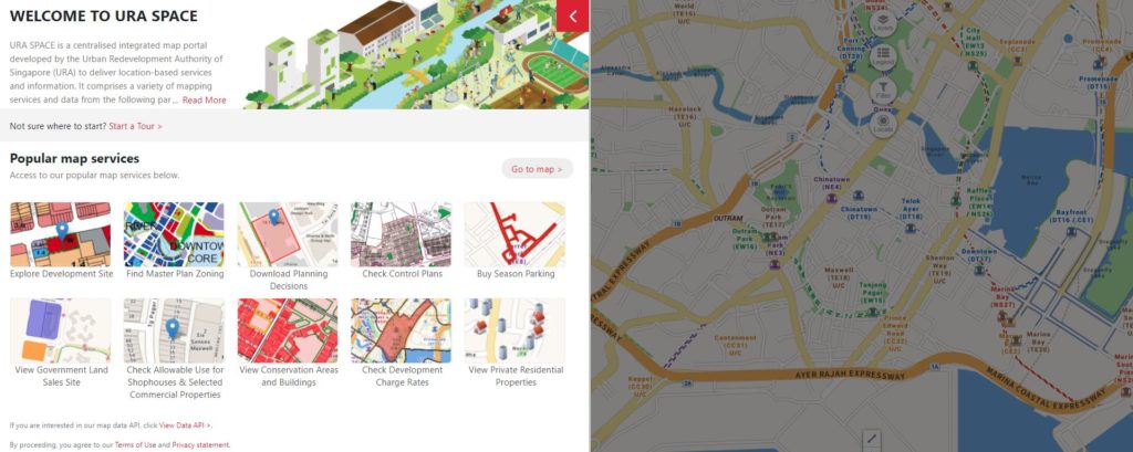
4. URA SPACE
A map portal developed by the Urban Redevelopment Authority of Singapore (URA) to deliver location-based services and geospatial data. Data is available throug it API.
5. Singapore Mobility Trip Patterns
CITYDATA computed the Mobility trip hops for Singapore as an open dataset.
6. ArcGIS Hub
Presented in Esri Singapore’s Open Data page – Open data capabilities of ArcGIS Hub make it possible to share and discover data.
7. OpenStreetMap
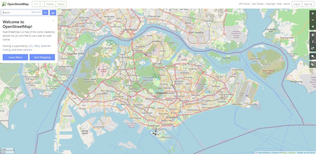
A collaborative project to create a free editable geographic database of the world. OpenStreetMap data is downloadable from the Geofabrik Download Server.
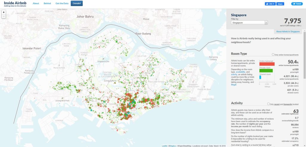
8. Inside Airbnb
The data is sourced from publicly available information from the Airbnb site.
9. Google COVID-19 Community Mobility Report – See how your community is moving around differently due to COVID-19
The reports chart movement trends over time by geography, across different categories of places such as retail and recreation, groceries and pharmacies, parks, transit stations, workplaces, and residential. Global and regional data are available for downloading in csv format.
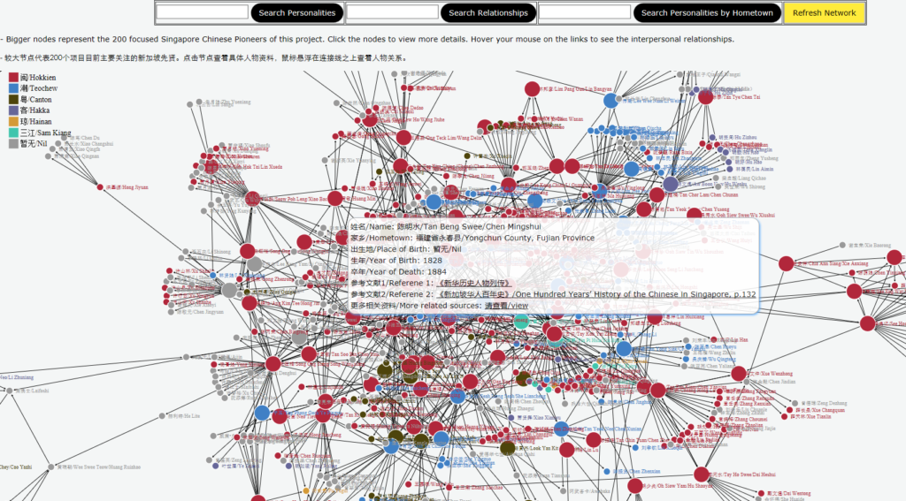
10. Singapore Biographical Database
The Singapore Biographical Database is a collaborative project by the National University of Singapore, the National Library Board of Singapore and the Singapore Federation of Chinese Clan Associations. It presents an interface that allows users to search individual prominent Singapore Chinese personalities and displays a social network of interpersonal connections and affiliations between them. Apart from biographical information, the database offers additional links to selected digital archives from the National Library, Singapore; the National Archives of Singapore and the photo archives from the Department of Chinese Studies, the National University of Singapore.
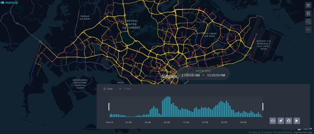
11. Grab-Posisi – A GPS Trajectory Dataset
The Grab-Posisi dataset contains in total 84K trajectories that consist of more than 80 million GPS pings and cover over 1 million km.
12. Geospatial statistics
Geospatial statistics are published by the Singapore Department of Statistics. They are available from the Population Trends, Census of Population and General Household Survey reports.
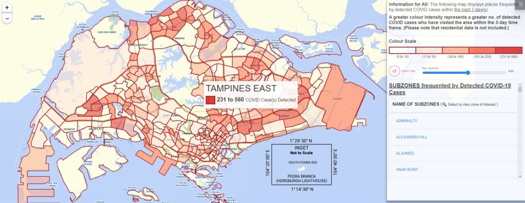
13. Covid Situation Report and Map
Published for the first time on Friday (Oct 1) 2021 by Ministry of Health (MOH) of Singapore, the map classifies areas into five bands or colour scales, displaying areas frequented by detected COVID-19 caces within the past 3 day(s)
14. Historical weather data
Meteorological service singapore provides historical daily weather data records (e.g., temperature, rainfall, and wind speed). The data is downloadable in csv and PDF formats.
15. Dengue clusters
Dengue cluster maps are provided by the National Environment Agency of Singapore.
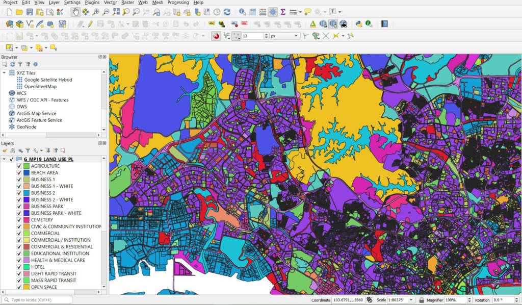
16. Master Plan 2019 Land Use layer
A land use polygon layer in KML format which can be saved as a ESRI shapefile using QGIS.